Living Neon — The Mind-Bending Science of Ocean Bioluminescence
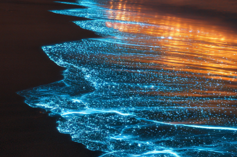
Step onto the right shoreline on a pitch-black, moonless night, and the sea might look like it was plugged directly into a wall outlet.
With every lapping wave, the surf flares electric blue. Dip your hand into the water, and your fingers trail ribbons of liquid starlight. Kick the wet sand, and it glitters like a disco ball.
This isn’t a special effect, and nobody dumped glowing dye into the water. You’re witnessing bioluminescence—one of the most surreal, sophisticated chemical tricks evolution ever pulled off.
While glowing creatures on land are rare novelties (think fireflies and a few peculiar mushrooms), bioluminescence in the ocean is the standard operating procedure. An estimated 75% to 90% of all deep-sea creatures make their own light.
Here is the brilliant chemistry, tactical warfare, and travel magic behind the ocean’s living glow.
The Spark: Cold-Light Chemistry 101
Human lightbulbs are terribly inefficient; they waste massive amounts of energy emitting heat. Nature figured out a much cooler design: chemiluminescence.
Biological light is nearly 100% efficient—producing almost zero radiant heat—via a simple two-part molecular recipe:
The Substrate (Luciferin): A light-emitting pigment molecule (named after Lucifer, the Latin term for "light-bringer").
The Engine (Luciferase): An enzyme that acts as a catalyst, sparking a reaction when it combines with oxygen and the luciferin.
The Power Surge: When oxygen bonds to luciferin in the presence of luciferase, the molecule enters an excited energetic state. As it relaxes back to its baseline, it releases that excess energy as a single photon of visible light.
Why is almost all marine bioluminescence blue or green? Because blue light has the shortest wavelength and travels the farthest through water, while red light is absorbed and scattered almost immediately.
The Dinoflagellate Disco: Why Coastal Waves Light Up
When you see an entire bay or breaking wave glowing neon turquoise, you’re looking at millions of single-celled marine plankton called dinoflagellates (most commonly species like Pyrodinium bahamense or Noctiluca scintillans).
These tiny creatures light up for a fraction of a second when they feel mechanical stress—like the shear force of a breaking wave, the stroke of a kayak paddle, or a fish swimming nearby.
Why blow their cover? It's a tactical defense known as the "Burglar Alarm Hypothesis":
A small crustacean or shrimp tries to eat the dinoflagellate.
The plankton flashes like a strobe light.
The flash blinds the grazer and illuminates it in the dark water.
A larger predatory fish sees the illuminated grazer and snaps it up, effectively saving the plankton colony.
Tactical Glow: How Deep-Sea Creatures Use Light
In the pitch-black abyss of the bathypelagic zone (below 3,300 feet), light is the ultimate multipurpose multi-tool:
The Deep-Sea Fishing Lure: The female Anglerfish sports an illicium—a fleshy spine protruding from its forehead tipped with a bulb full of glowing, symbiotic bacteria. Curious prey swim right up to inspect the midnight snack, straight into a mouth full of needle-sharp teeth.
The Invisibility Cloak (Counterillumination): The Hatchetfish and Lanternfish have rows of glowing photophores on their bellies. By matching the intensity and color of their downward glow to the faint ambient sunlight filtering from above, they erase their silhouettes, making them invisible to predators lurking beneath them.
The Smoke Screen: Deep-sea squid and glowing shrimp don’t shoot black ink (which is useless in the pitch black). Instead, they shoot a cloud of luminous, glowing mucus that temporarily blinds and confuses predators while the squid jets away into the darkness.
Chasing the Glow: The Best Bioluminescent Bays on Earth
To experience this firsthand, you need very specific conditions: warm, nutrient-rich, sheltered coastal lagoons with narrow outlets to the sea, visited during a New Moon (when skies are darkest).
Destination
Location
What Makes It Special
Mosquito Bay
Vieques, Puerto Rico
Officially the brightest bioluminescent bay on Earth, packed with up to 700,000 dinoflagellates per gallon.
Luminous Lagoon
Falmouth, Jamaica
Extremely consistent, brilliant blue glow caused by unique brackish mangrove waters.
Grand Cayman Bio Bay
Cayman Islands
A sheltered, shallow inlet offering magical midnight glass-bottom kayak tours.
Bio Bay (Bahía Fosforescente)
Lajas, Puerto Rico
One of the classic bioluminescent locations with easy evening boat departures.
Seeing the ocean ignite around your paddle is an experience that stays with you forever. It is an unforgettable reminder that nature is the greatest light show on earth.
The Cosmic Tug-of-War — The Surprising Physics That Drive Ocean Tides
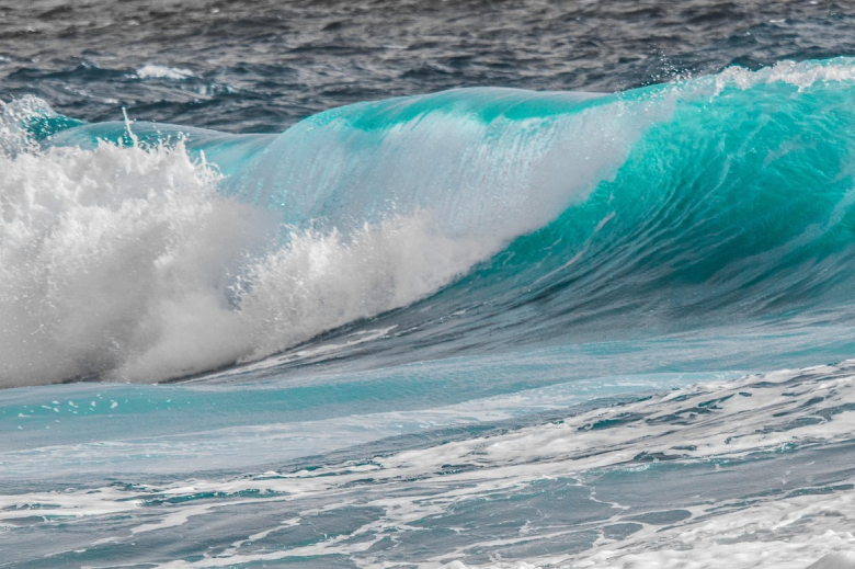
Twice a day, billions of tons of seawater rhythmically rise up against the shore, submerge beaches, and retreat back into the deep.
We take this celestial dance for granted. We track it to park our beach towels and launch our paddleboards but pause for a moment to consider the sheer scale of what is happening: the oceans are being physically stretched and pulled across the surface of our planet by cosmic gravitational forces hundreds of thousands of miles away.
Tides are not random waves. They are planetary-scale kinetic energy at work.
Here is the surprisingly weird, elegant physics behind what makes the ocean rise and fall—and why there is always a second high tide on the exact opposite side of the world.
The Moon, the Bulge, and the "Opposite Side" Mystery
Most people know the moon’s gravity pulls the ocean toward it, creating a high-tide bulge on the side of the Earth facing the moon.
The real brain-teaser is this: Why is there a simultaneous high tide on the other side of the Earth, facing completely away from the moon?
The answer lies in the difference between gravity and inertia:
The Moon-Facing Side: The moon's gravitational pull is strongest here because it is closest. It pulls the water toward itself, creating Bulge 1 (the near-side high tide).
The Center of the Earth: The Earth itself feels an average gravitational pull and gets tugged slightly toward the moon.
The Far Side: The ocean water on the far side is furthest from the moon, feeling the weakest gravitational pull. Because the Earth is spinning around a shared center of mass (the barycenter), inertia and centrifugal force fling that distant water outward, creating Bulge 2 (the far-side high tide).
As the Earth spins on its axis every 24 hours, your local beach rotates through these two bulges, giving you two high tides and two low tides each day.
The Solar Tag-Team: Springs and Neaps
The moon is the primary conductor of the tides because it is close, but the sun is a massive, heavyweight player.
Even though the sun is 400 times further away, its sheer mass gives it roughly 44% of the moon’s tide-generating power. Depending on where the sun and moon sit relative to one another, they either team up or fight each other.
Spring Tides (The Amplified Tides):
When: During the Full Moon and New Moon.
The Alignment: The Earth, Moon, and Sun sit in a straight line (known as syzygy).
The Effect: Their gravitational pulls combine into a powerhouse force. High tides hit extreme peaks, low tides drop to historic lows, and tidal currents move at maximum velocity.
Neap Tides (The Mellow Tides):
When: During the First Quarter and Third Quarter moons.
The Alignment: The Sun and Moon sit at a 90-degree right angle relative to Earth.
The Effect: The sun’s gravity partially cancels out the moon’s pull. High tides are unusually modest, low tides are relatively shallow, and the water stays calm and tame.
Why Aren't Tides the Same Everywhere?
If the moon's gravity were the only factor, every coastline on Earth would have an identical 3-foot tide twice a day.
In reality, tidal ranges vary wildly depending on coastal geography and ocean basin geometry:
The Funnel Effect (Bay of Fundy, Canada): The Bay of Fundy boasts the highest tidal range on the planet—a staggering 53 feet between high and low tide. The bay’s V-shape and natural underwater depth funnel incoming water like a giant sloshing bathtub that resonates in perfect harmony with the ocean's tidal frequency.
The Mediterranean Enigma: The Mediterranean Sea has an average tidal range of less than a single foot. Because it connects to the Atlantic through the narrow Strait of Gibraltar, water cannot enter and exit fast enough to create large tidal swings before the cycle reverses.
Tidal Bores (Rivers That Flow Backward): When powerful incoming ocean tides force their way into narrow river estuaries (like the Amazon River in Brazil or the River Severn in the UK), they form a continuous, standing wave that travels miles upriver against the natural flow of the current.
The Global Energy Machine
Beyond dictating your beach setup, tides are vital to the health of the planet:
Circulating Nutrients: Tides pump oxygen-rich surface water into coastal marshes and dredge nutrient-dense sediment out into open water, feeding microscopic phytoplankton at the base of the food chain.
Renewable Energy: Because tides are 100% predictable centuries in advance (unlike wind or sun), underwater tidal stream turbines generate steady, reliable zero-emission electricity for coastal electrical grids.
Every wave that rolls across the sand is a handshake between our oceans and the cosmos. Understanding the science turns every high tide into a front-row seat to the clockwork of the solar system.
The Ultimate Guide to Praia da Marinha: The Algarve’s Golden Masterpiece
When travel magazines and guidebooks attempt to capture the essence of Portugal’s spectacular southern coastline, they almost always use a photograph of Praia da Marinha. Tucked into the Lagoa municipality in the central Algarve, this cove is a breathtaking amphitheater of towering, golden limestone cliffs, rugged sea stacks, and vibrant turquoise water. It is consistently ranked not just as one of the best beaches in Europe, but as one of the most beautiful in the entire world.
Welcome to the ultimate travel guide to Praia da Marinha. Whether you are an avid hiker looking to tackle the famous clifftop trails, a photographer chasing the perfect sunset, or a sun-seeker wanting to float in crystalline waters, this comprehensive guide covers everything you need to know about the Algarve's crown jewel.
Why It’s Worth Knowing About
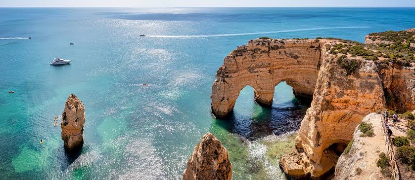
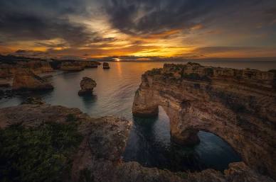
Praia da Marinha’s fame is deeply rooted in its astonishing geology. Millions of years of wind and Atlantic waves have sculpted the soft limestone cliffs into a surreal landscape of dramatic pinnacles, hidden sea caves, and natural arches.
The breathtaking golden cliffs of Praia da Marinha. Source: Facebook
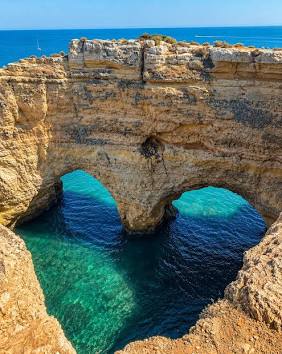
Perhaps the most famous of these formations is the spectacular double sea arch located just off the shore. Known as the "M Rock" or "Elephant Rock" (because it resembles an elephant drinking from the ocean from certain angles), this massive limestone structure is the icon of the Algarve. When viewed from the clifftop pathway at the right angle, the double arches perfectly frame the turquoise water below, creating an optical illusion that resembles a giant heart.
Praia da Marinha is also worth knowing about because of its remarkable state of preservation. Unlike many other famous European beaches, you won't find massive, high-rise hotels or sprawling commercial developments looming over the sand. The cliffs have kept the beach somewhat insulated from overdevelopment. To access the sand, visitors must descend a long, winding stone staircase built directly into the cliffside. This natural barrier has helped Marinha retain its raw, untamed, and deeply romantic atmosphere, earning it a prestigious classification as a "Golden Beach" by the Portuguese Ministry of the Environment.
Water Data: Temperature & Clarity
The waters of the Algarve are influenced by the Atlantic Ocean, meaning they offer a very different experience than the bath-like temperatures of the Caribbean or the Gulf of Mexico.
Water Temperatures by Season
While the Algarve enjoys over 300 days of sunshine a year, the Atlantic waters remain incredibly refreshing. Here is what you can expect from the sea temperature at Praia da Marinha based on historical data:
Season
Avg. Water Temp
How it Feels
Winter (Dec - Feb)
59°F - 61°F (15°C - 16°C)
Very chilly. Strictly wetsuit territory for surfers or divers; too cold for casual swimming.
Spring (Mar - May)
60°F - 64°F (16°C - 18°C)
Brisk and invigorating. By late May, quick, refreshing dips are manageable.
Summer (Jun - Aug)
67°F - 70°F (19°C - 21°C)
The peak warmth. It is highly refreshing and perfect for cooling off after sunbathing on the hot sand.
Fall (Sep - Nov)
66°F - 70°F (19°C - 21°C)
September holds onto summer warmth beautifully. By November, the water rapidly cools back into the low 60s.
Water Clarity
Praia da Marinha boasts some of the clearest water in Portugal. Because the beach is nestled deep within a cove and protected by towering cliffs and sea stacks, the water here is often remarkably calm compared to the western edge of the Algarve. This calmness allows any suspended sand to settle, resulting in a mesmerizing, glassy clarity. The water color frequently shifts between a deep sapphire blue and a striking, translucent turquoise, making it an exceptional spot for snorkeling.
Marine Life
The calm waters and the abundance of submerged limestone rocks and caves make Praia da Marinha a thriving habitat for coastal marine life. It is widely considered one of the best snorkeling beaches in the Algarve.
Octopus and Cuttlefish
The rocky crevices and underwater caves at the base of the sea stacks provide the perfect hiding spots for the common octopus. If you snorkel quietly around the edges of the submerged rocks, you may spot them camouflaging against the limestone. Cuttlefish are also a frequent, fascinating sight, hovering in the shallow waters.
Sea Anemones and Starfish
The tidal pools that form around the base of the cliffs during low tide are miniature ecosystems of their own. They are heavily populated with vibrant red beadlet anemones, small crabs, sea urchins, and the occasional starfish clinging to the rocks.
Coastal Reef Fish
Snorkelers can expect to swim alongside large schools of two-banded seabream, colorful wrasse, and small groupers. Because the water is so clear, you don't need to swim far from the shore to feel like you are inside an aquarium.
Seabirds and Dolphins
Above the surface, the towering cliffs are a sanctuary for seabirds, including yellow-legged gulls, cormorants, and even the occasional peregrine falcon nesting high in the limestone. If you take a boat tour further out from the cove, the deeper waters off the coast of Lagoa are famous feeding grounds for playful pods of common and bottlenose dolphins.
Best Time to Go
Choosing the right time to visit Praia da Marinha depends heavily on whether you prioritize swimming in the ocean or hiking the spectacular clifftops.
The Sweet Spots (May & September to October): These shoulder months are universally considered the best times to visit. The weather is gorgeous (with daytime highs in the mid-70s to low-80s), the ocean is either warming up or holding onto summer heat, and the intense summer crowds are absent. It is the perfect balance for both hiking the cliffs and relaxing on the sand.
Peak Summer (July to August): If your primary goal is swimming and sunbathing, this is when the water is at its warmest. The weather is reliably hot, dry, and sunny. However, Praia da Marinha is world-famous, and during these months, it gets incredibly crowded. Parking becomes a massive challenge unless you arrive before 9:00 AM, and the small strip of sand fills up quickly.
Winter and Early Spring (December to April): The winter months are mild and sunny, though you will encounter occasional rain showers. The water is far too cold for swimming, but this is arguably the best time of year for avid hikers and photographers. You will have the breathtaking cliff trails almost entirely to yourself, surrounded by blooming spring wildflowers.
Getting There, Getting Around, & Where to Stay
Getting There
The gateway to the Algarve is Faro International Airport (FAO), located about a 45-minute drive east of Praia da Marinha. Faro is heavily serviced by budget airlines from all over Europe, making it incredibly accessible. If you are flying from outside Europe, you will typically fly into Lisbon (LIS) and then take a beautiful 2.5-hour drive south or catch a high-speed train down to the Algarve.
Getting Around
While the Algarve does have a public bus and train network, it is not well-suited for beach-hopping or reaching secluded spots like Praia da Marinha.
Renting a Car: This is highly recommended. Having your own vehicle allows you to explore the dramatic coastline at your own pace. The drive to Marinha is scenic, passing through small coastal towns and rural landscapes.
Rideshares & Taxis: Uber and local taxis operate throughout the Algarve and are a viable option if you prefer not to drive, though wait times can be longer outside of the main towns.
Where to Stay
Praia da Marinha does not have hotels situated directly on its cliffs, which preserves its natural beauty. However, excellent accommodations are just a short drive away:
Carvoeiro: A picturesque, whitewashed fishing village turned resort town located just 15 minutes west of Marinha. It is built into the cliffs surrounding a beautiful cove and is packed with fantastic seafood restaurants, lively bars, and boutique hotels. It is the perfect home base for exploring the central Algarve.
Lagoa / Porches: If you prefer luxury and seclusion, the areas slightly inland or along the coast near Porches feature several incredible five-star cliffside resorts (such as Vila Vita Parc), offering massive grounds, spa facilities, and private beach access.
Lagos: Located about 40 minutes to the west, Lagos is a larger, historic city with a vibrant nightlife, charming cobblestone streets, and a younger, highly energetic backpacker and surfer vibe.
Things To Do
Praia da Marinha is not just a place to lay a towel; it is an active, visually stunning playground.
Hike the Seven Hanging Valleys Trail
If there is one activity you must do in the Algarve, it is this. The Percurso dos Sete Vales Suspensos (Seven Hanging Valleys Trail) is consistently voted one of the most beautiful coastal hikes in Europe. The trail begins right at the Praia da Marinha parking lot and stretches for roughly 3.5 miles (5.7 km) westward to Praia de Vale Centeanes.
The hike takes you along the very edge of the limestone cliffs, weaving through aromatic juniper bushes and offering jaw-dropping views of hidden coves, dramatic drop-offs, and the famous Alfanzina Lighthouse. It is moderately challenging due to uneven, rocky terrain, so proper walking shoes and plenty of water are essential.
Explore the Benagil Sea Cave
Just a short distance west of Praia da Marinha lies the world-famous Benagil Cave (Algar de Benagil). This massive sea cave features a natural skylight in its dome and a hidden beach inside. You cannot walk to the inside of the cave; it is only accessible by water. You can book boat tours, rent kayaks, or join a stand-up paddleboard tour from nearby beaches (like Benagil Beach) to navigate inside this incredible natural cathedral.
Snorkel the M-Rock
Descend the stairs to the beach, put on your mask, and swim out toward the massive sea stacks and the famous double arches. The water around the base of these rocks is incredibly clear and teems with coastal marine life.
Beach-Hop by Boat
While the views from the cliffs are spectacular, seeing the Algarve coastline from the water provides an entirely different perspective. Numerous local operators offer small boat or catamaran tours that depart from nearby marinas (like Portimão or Carvoeiro). These tours weave in and out of the sea caves, sail right through the natural arches at Marinha, and allow you to see secluded beaches that are completely inaccessible by land.
Watch the Sunset
The golden hour at Praia da Marinha is a spiritual experience.
Because the cliffs are composed of limestone, they absorb the late afternoon light and practically glow in intense shades of ochre, gold, and burning orange. The best viewpoint is not on the beach itself, but from the clifftop trail just to the right of the main parking area. Bring a blanket, sit near the edge, and watch the sun dip below the Atlantic horizon.
Sunset illuminating the sea stacks at Praia da Marinha. Source: Facebook
The Ultimate Guide to Shoal Bay: Anguilla’s Powdery White Masterpiece
When you dream of the ultimate, quintessential Caribbean escape, your imagination is likely painting a picture of Shoal Bay. Situated on the quiet, slender island of Anguilla, this two-mile stretch of coastline—often referred to locally as Shoal Bay East to distinguish it from its western counterpart—is repeatedly crowned one of the finest beaches in the world. Welcome to the ultimate travel guide to Shoal Bay, Anguilla. Offering a profoundly relaxing, uncrowded atmosphere that caters beautifully to mature travelers seeking refined comfort, this destination balances upscale luxury with barefoot Caribbean charm. Whether you want to snorkel a vibrant fringing reef just offshore, enjoy a world-class rum punch under a seagrape tree, or simply walk for miles on blindingly white sand, this comprehensive guide covers everything you need to know.
Why It’s Worth Knowing About
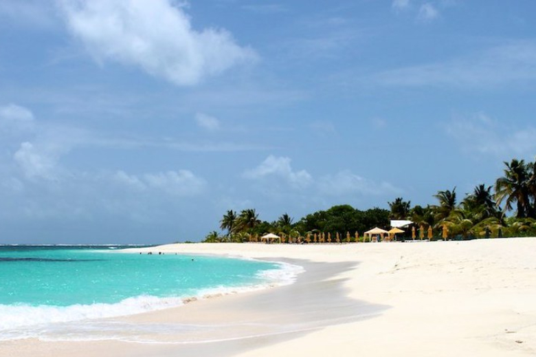
Shoal Bay East is not just another beautiful Caribbean beach; it is a masterclass in coastal perfection. The sand here is legendary. It is exceptionally fine, brilliantly white, and frequently boasts a subtle, glowing pink hue at the water's edge due to crushed coral fragments mixing with the sand over thousands of years. Because the sand is so powdery and devoid of sharp rocks, it offers a phenomenally comfortable, low-impact walking surface that is gentle on the joints.
Beyond the spectacular sand, Shoal Bay is worth knowing about because of its perfectly balanced atmosphere. Unlike the mega-resort beaches of neighboring islands, Anguilla has purposefully avoided mass commercialization. There are no towering high-rises or chaotic cruise ship terminals here. Instead, the beach is lined with a smattering of low-slung luxury boutique hotels, charming villas, and colorful, open-air beach bars. It delivers the vibrant, musical soul of the Caribbean in a deeply relaxed, sophisticated, and highly accessible environment.
Water Data: Temperature & Clarity
Floating in the eastern Caribbean Sea, the water conditions at Shoal Bay are exceptionally inviting year-round. An expansive, offshore coral reef protects the bay from heavy Atlantic surf, ensuring the waters remain wonderfully calm.
Water Temperatures by Season
Anguilla enjoys a beautifully consistent tropical climate, meaning the ocean is always ready for a swim.
Winter (Dec - Feb): 79°F - 80°F (26°C - 27°C). Flawlessly comfortable. It offers a spectacular, refreshing escape for those fleeing freezing northern temperatures.
Spring (Mar - May): 79°F - 82°F (26°C - 28°C). Perfectly balanced. The water remains wonderfully inviting for long, relaxing swims and water aerobics.
Summer (Jun - Aug): 83°F - 84°F (28°C - 29°C). Extremely warm. It feels like a massive heated pool, providing the ultimate relaxing soak on a hot tropical day.
Fall (Sep - Nov): 82°F - 84°F (28°C - 29°C). Retains the peak summer heat. The water is fantastic, though this season aligns with the height of the Atlantic hurricane season.
Water Clarity
The clarity at Shoal Bay is breathtaking. Because the fringing reef acts as a natural breakwater, the bay is typically waveless and glassy. There is virtually no suspended sediment, resulting in a striking, translucent turquoise color that practically glows in the sunlight. You can easily wade out waist-deep and see your toes perfectly on the soft, sandy bottom.
Marine Life
The protective coral reef that keeps Shoal Bay so calm also serves as a bustling, vibrant sanctuary for Caribbean marine life. It is one of the most accessible and rewarding snorkeling spots on the island.
Sea Turtles: The warm, clear shallows around Anguilla are frequent grazing grounds for Green and Hawksbill sea turtles. If you snorkel near the coral heads at the eastern edge of the bay, it is incredibly common to swim alongside these gentle, graceful creatures.
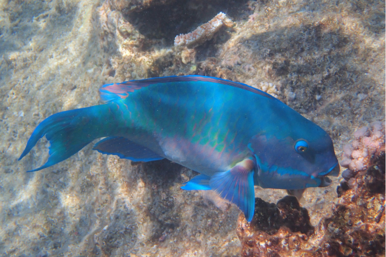
Tropical Reef Fish: You do not need to book a boat to see incredible marine life; the reef at Shoal Bay is accessible directly from the shore. Just a short swim from the beach, the underwater landscape explodes with vibrant parrotfish, blue tangs, sergeant majors, and butterflyfish darting through the coral formations.
Stingrays: While walking the shallow sandbars, keep an eye out for southern stingrays gliding smoothly along the bottom, perfectly camouflaged against the white sand.
Best Time to Go
Choosing the right time to visit Anguilla requires balancing perfect weather with the realities of the Atlantic hurricane season and the island's unique seasonal closures.
The Golden Window (December to April): This is the undisputed high season for Anguilla. The weather is spectacular—think endless blue skies, low humidity, and daytime highs resting comfortably in the low 80s. It is the absolute best time for those seeking guaranteed sunshine and a flawlessly comfortable climate. However, you must book well in advance, as hotels sell out quickly during the winter "snowbird" rush.
The Spring Sweet Spot (May to July): These months are a fantastic, highly recommended time to visit. The winter crowds have thinned out, the ocean has warmed up significantly, and you can often find better rates on luxury accommodations before the heavy summer rains begin.
Hurricane Season & Closures (September to October): While the ocean is at its warmest, this is the peak of the Atlantic hurricane season. It is critical to know that Anguilla essentially shuts down during September and October. Many of the top hotels, beach bars, and restaurants close their doors entirely for annual renovations and staff holidays.
Getting There, Getting Around, & Where to Stay
Getting There
The journey to Anguilla is wonderfully scenic and part of the authentic Caribbean experience.
By Air: You can fly directly into Anguilla's Clayton J. Lloyd International Airport (AXA) via direct flights from Miami (American Airlines) or through regional carriers connecting from Puerto Rico or Antigua.
The St. Maarten Route (Most Popular): Most visitors fly into neighboring St. Maarten (SXM). From the airport, you take a short taxi ride to the ferry terminal and board a comfortable, 25-minute public or private sea shuttle across the channel directly to Anguilla's Blowing Point Ferry Terminal.
Getting Around
Anguilla is a small, relatively flat island (about 16 miles long), making it very easy to navigate.
Rental Cars: Renting a car is the best way to explore the island at your own pace. The roads are generally well-paved, safe, and easy to traverse. Note: Driving in Anguilla is on the left side of the road.
Taxis: Taxis are readily available at the ferry terminal and all major resorts. Fares are unmetered and based on set zone rates, making pricing highly transparent and stress-free.
Where to Stay
Shoal Bay offers an incredible mix of high-end resorts and comfortable, spacious villas.
Zemi Beach House: Situated directly on Shoal Bay East, this luxury boutique resort offers unparalleled comfort, world-class dining, a stunning Thai-inspired spa, and zero-entry pools. It is the epitome of refined, accessible island luxury.
Shoal Bay Villas: Located right on the sand, these well-appointed, apartment-style villas are a beloved staple of the island. They offer full kitchens, comfortable living spaces, and a wonderfully quiet, residential feel perfect for longer stays.
The Manoah Boutique Hotel: A highly elegant, modern property offering spectacular ocean views, a massive beachfront pool, and bright, airy rooms just steps from the turquoise water.
Things To Do
A trip to Shoal Bay is about embracing a slower, more refined pace. Your itinerary should prioritize culinary indulgence, easy exploration, and long hours by the water.
Walk the Two-Mile Stretch: Because the sand is incredibly powdery and free of sharp rocks, Shoal Bay is arguably one of the best walking beaches in the Caribbean. Wake up early, leave your shoes at your resort, and enjoy a low-impact stroll as the morning sun illuminates the vibrant turquoise water. The eastern point of the beach (known as "The Bend") offers complete solitude.
Snorkel the Home Reef: Bring your mask and fins or rent them from a local vendor on the beach. You can swim out to the fringing reef directly from the sand. It is incredibly safe, shallow, and visually rewarding, making it an effortless underwater excursion.
Dine at the Iconic Beach Bars: Shoal Bay is famous for its relaxed, toes-in-the-sand culinary scene. Grab a seat under a palm tree at Gwen’s Reggae Grill, order a legendary rum punch, listen to live reggae, and enjoy a plate of perfectly grilled local snapper or ribs. Or pop over to Uncle Ernie’s Beach Bar right in the center of Shoal Bay to grab an affordable, casual lunch and a cold Carib beer without leaving the beach.
Photo Credit: Andrew Hayman
Enjoy a Refined Sunset: While Shoal Bay faces north and the sun typically sets on the western end of the island, the fading light turns the entire bay into a serene, pastel paradise. As the day-trippers head back to their villas, the beach empties out. Grab a towel, find a quiet spot on the sand, and watch the sky shift into brilliant shades of orange and violet as the Caribbean breeze cools you down.
The Ultimate Guide to Flamenco Beach: Puerto Rico’s Caribbean Masterpiece
When travelers dream of the perfect Caribbean beach, they are usually picturing a very specific combination: blindingly white sand, water so vividly turquoise it looks illuminated from below, and a lush, mountainous backdrop. Flamenco Beach, located on the small island of Culebra just off the eastern coast of Puerto Rico, delivers this exact fantasy with effortless perfection. Consistently ranked among the top beaches in the world, it is a destination that completely justifies its massive global reputation. Welcome to the ultimate travel guide to Flamenco Beach. Whether you are looking to snorkel in calm, gin-clear shallows, enjoy a fresh empanada under a palm tree, or photograph the iconic, graffiti-covered relics of its unique history, this comprehensive guide covers everything you need to know about Puerto Rico’s most spectacular stretch of sand.
Why It’s Worth Knowing About
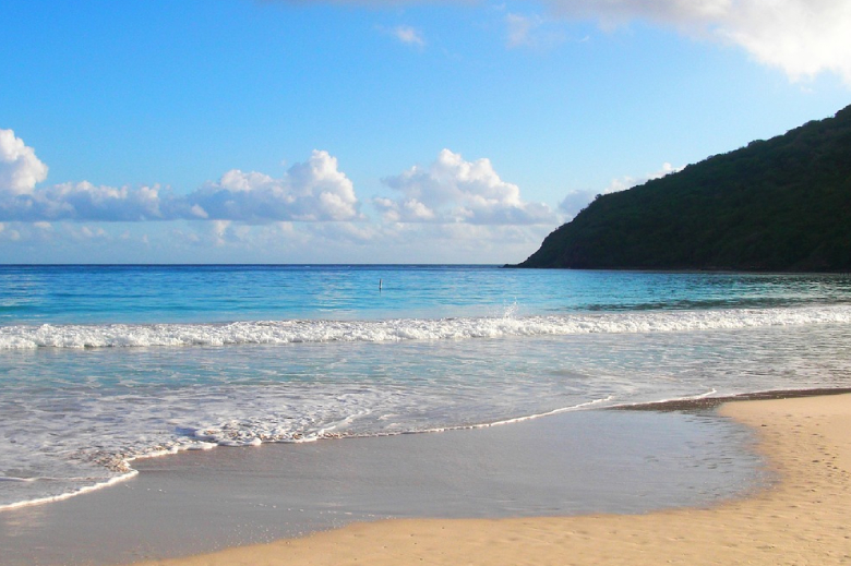
Flamenco Beach is a perfectly protected, horseshoe-shaped bay spanning nearly a mile and a half of pristine coastline. The sand here is spectacularly fine and bright white, bordered by a dense, verdant nature reserve rather than towering mega-resorts. Because the bay is sheltered by outlying coral reefs, the water is incredibly calm, making it one of the most comfortable and safe swimming beaches in the Caribbean.
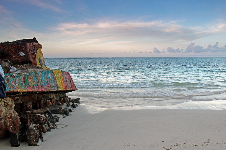
However, what truly makes Flamenco Beach unique is its fascinating, visible history. For decades, the U.S. Navy used Culebra—and Flamenco Beach specifically—as a gunnery and bombing practice range. Following years of peaceful protests by the local residents, the Navy finally departed the island in 1975. When they left, they abandoned several massive Sherman tanks directly on the beach. Over the past half-century, the salty sea winds have rusted the metal, and locals and visitors have continuously painted the tanks with vibrant graffiti. Today, these colorful, rusting war machines sit half-buried in the pristine white sand, serving as powerful monuments of peace and providing one of the most unique, iconic photo opportunities in the world.
Floating in the tropical waters of the Caribbean Sea, the ocean conditions at Flamenco Beach are exceptionally inviting year-round.
Water Temperatures by Season
Puerto Rico enjoys a beautifully consistent tropical climate, meaning you will never need a wetsuit for casual swimming or snorkeling.
Winter (Dec - Feb): 80°F - 81°F (26°C - 27°C). Flawlessly warm. It offers a spectacular, bath-like escape for those fleeing freezing northern temperatures.
Spring (Mar - May): 79°F - 81°F (26°C - 27°C). Perfectly comfortable. The water remains wonderfully inviting for long, relaxing swims.
Summer (Jun - Aug): 83°F - 84°F (28°C - 29°C). Extremely warm. It feels like a massive heated pool, providing the ultimate relaxing soak on a hot day.
Fall (Sep - Nov): 83°F - 84°F (28°C - 29°C). Retains the peak summer heat. The water is fantastic, though this season aligns with the height of the Atlantic hurricane season.
Water Clarity
The clarity at Flamenco Beach is legendary. Because the horseshoe bay is protected from heavy Atlantic surf by a series of reefs, the water is generally waveless and glassy. There is very little suspended sediment, resulting in a striking, translucent turquoise color. You can easily wade out to your chest and see your toes perfectly on the soft, sandy bottom.
Marine Life
The calm, protected waters of the Culebra archipelago make it a thriving sanctuary for Caribbean marine life.
Sea Turtles: Culebra is world-renowned for its sea turtle population. The beaches here serve as critical nesting grounds for leatherback and hawksbill turtles. While you might not see them nesting during the day, snorkeling in the seagrass beds just off the beach—or at nearby Tamarindo Beach—frequently rewards you with the incredible experience of swimming alongside these gentle creatures.
Tropical Reef Fish: If you bring a snorkel and swim toward the rocky edges of the bay, you will find vibrant fringing reefs. Expect to see colorful parrotfish, blue tangs, sergeant majors, and occasionally a spotted eagle ray gliding smoothly over the sandy shallows.
Best Time to Go
Culebra can be enjoyed year-round, but your experience will vary significantly depending on the season.
Winter (December to February): This is the peak tourist season. The weather is spectacular (highs in the low 80s) and the rainfall is low. It is the absolute best time for a flawless beach day, but you must book ferries and accommodations well in advance as the island is busy.
The Spring Sweet Spot (March to May): Spring offers a fantastic balance. The weather remains gorgeous, and after the spring break rush in March, the crowds thin out slightly in April and May, providing a more relaxed island vibe.
Summer (June to August): This is when Puerto Ricans flock to Culebra for their summer vacations. The beach takes on a highly festive, local, and energetic atmosphere. It is hot and humid, mas the extraordinarily warm ocean water is perfect for endless swimming.
Fall (September to November): This is the quietest time on the island, primarily because it coincides with the Atlantic hurricane season. While you can score excellent travel deals and have the beach almost entirely to yourself, the weather is unpredictable.
Getting There, Getting Around, & Where to Stay
Getting There
Reaching Culebra requires an extra step from the main island of Puerto Rico, which helps keep it from feeling overly commercialized.
By Air: The easiest, most scenic way is to take a quick, 30-minute puddle-jumper flight from San Juan (either SJU or Isla Grande airport) directly to Culebra’s small airport.
By Ferry: A much cheaper alternative is taking the passenger ferry from the town of Ceiba (on the east coast of Puerto Rico). The ferry takes about 45 minutes to an hour. Tip: Book your ferry tickets online weeks in advance, as they sell out incredibly quickly.
Getting Around
Públicos (Shared Taxis): When you arrive at the ferry dock or airport, you will find rows of públicos (vans). For a few dollars, they will shuttle you directly to Flamenco Beach.
Golf Carts & Jeeps: Renting a golf cart or a Jeep is the best way to explore the island at your own pace. The roads are hilly, but zipping around the island in an open-air golf cart is half the fun of a Culebra vacation.
Where to Stay
There are no massive, towering resorts on Culebra, which is exactly why people love it.
Dewey (The Main Town): Staying in the small town of Dewey puts you within walking distance of the ferry terminal, local restaurants, and bars. It is a fantastic home base for renting a cart and exploring daily.
Boutique Villas: The hillsides surrounding the island offer numerous private villas and small guesthouses that provide stunning ocean views and quiet luxury.
Camping on the Beach: For the adventurous, Flamenco Beach features a designated, government-run campground directly behind the tree line. It is one of the only places in Puerto Rico where you can legally pitch a tent steps from the ocean (always verify that the facilities are currently open before arriving).
Things To Do
Flamenco Beach offers a perfect blend of absolute relaxation, unique history, and local culinary flavor.
Photograph the Iconic Tanks: This is the most famous activity on the beach. Walk toward the rocky western end of the bay to find the most prominent Sherman tank. Its rusting hull is covered in layers of vibrant, ever-changing graffiti. Sitting in stark contrast against the brilliant white sand and turquoise water, it is a uniquely powerful and visually striking monument.
Eat at the Kioskos: You do not need to pack a massive cooler for a day here. Right at the entrance to the beach, tucked beneath the trees, is a row of food kiosks. They serve incredible local beach fare—grab a fresh, flaky empanada (pastelillo), some fried fish, and a piña colada or a cold Medalla beer, and enjoy lunch in the shade.
Snorkel the Reefs: Bring your mask and fins. Because the water is so calm, you can swim out to the rocky edges of the horseshoe bay to explore the fringing reefs. It is incredibly safe, shallow, and visually rewarding.
Watch the Sunset: While the beach faces slightly north, the fading light of the day turns the entire bay into a serene, pastel paradise. As the day-trippers head back to the ferry terminal, the beach empties out. Grab a towel, find a quiet spot on the sand, and watch the sky shift into brilliant shades of orange and violet as the Caribbean sun dips below the lush green hills.