The Ultimate Guide to Spiaggia dei Conigli: Italy’s Southernmost Masterpiece
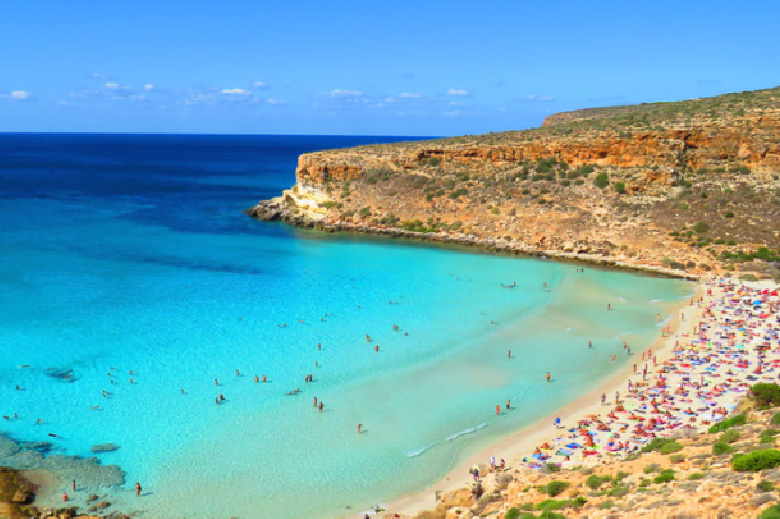
When searching for the absolute pinnacle of Mediterranean beauty, you have to look beyond the mainland. Far south of Sicily, resting closer to the coast of North Africa than to Europe, lies the sun-baked island of Lampedusa. And tucked into its rugged southern coast is Spiaggia dei Conigli—Rabbit Beach. Consistently voted the best beach in Europe and frequently ranked among the top in the world, this is a destination that delivers an almost profound sense of natural wonder. Welcome to the ultimate travel guide to Spiaggia dei Conigli. Offering a spectacular blend of protected wildlife, blindingly white sand, and water that looks like liquid glass, it is a destination that rewards a slightly slower, more deliberate pace of travel. Whether you prefer a leisurely boat tour along the limestone cliffs or a peaceful morning wading in the impossibly clear shallows, this comprehensive guide covers everything you need to know about Italy’s most pristine coastal jewel.
Why It’s Worth Knowing About
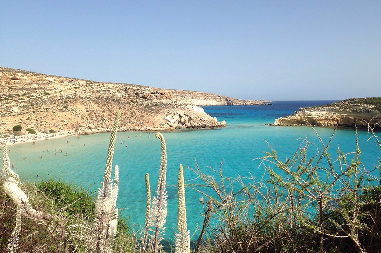
Spiaggia dei Conigli is not just a beautiful beach; it is a highly protected, pristine nature reserve. The cove is formed by a magnificent sweeping bay of soft white sand, framed by rugged, arid limestone cliffs. Just a few dozen yards offshore sits the Isola dei Conigli (Rabbit Island), a small rocky islet that completes the breathtaking panorama.
What truly sets this beach apart is the water's depth. The gradient here is incredibly gradual. You can wade out for dozens of yards before the water even reaches your waist. This makes it an exceptionally comfortable, low-impact environment for leisurely floating and walking in the sea without having to battle heavy surf or sudden drop-offs. Furthermore, the beach is zealously protected by Legambiente (an Italian environmental organization). To keep the area pristine, there are no beach clubs, no loud music, and no permanent structures on the sand. Access requires a booking system during peak months and a 15-to-20-minute walk down a paved and stepped stone path from the main road. While this descent requires decent mobility, the reward at the bottom is an atmosphere of absolute, unspoiled tranquility that is increasingly rare in modern Europe.
Water Data: Temperature & Clarity
Floating in the Pelagie archipelago in the deep Mediterranean, Lampedusa’s climate is distinctly North African. The water here is spectacular, though it follows the standard Mediterranean seasonal shifts.
Water Temperatures by Season
Thanks to its extreme southern location, Lampedusa boasts one of the longest, most comfortable swimming seasons in all of Italy.
Winter (Dec - Feb): 59°F - 62°F (15°C - 17°C). Brisk and chilly. While the island is peaceful, it is generally too cold for casual swimming.
Spring (Mar - May): 62°F - 68°F (17°C - 20°C). Refreshing. By late May, the shallow bay warms up significantly, making it lovely for wading and quick dips.
Summer (Jun - Aug): 75°F - 82°F (24°C - 28°C). Flawlessly warm and bath-like. The shallow water heats up beautifully sob the summer sun, providing a perfect, relaxing soak.
Fall (Sep - Nov): 71°F - 79°F (22°C - 26°C). September and October are absolute perfection, holding onto the peak summer warmth before finally cooling off in late November.
Water Clarity
The clarity at Rabbit Beach defies belief. Because the bay is protected and the bottom is composed of fine, heavy white sand and limestone, there is virtually no sediment suspension. The water is often described as looking like a massive, crystal-clear swimming pool. You can stand chest-deep and see the individual grains of sand and small fish darting around your feet with absolute, perfect visibility.
Marine Life
Spiaggia dei Conigli is not just a beach; it is a vital ecological sanctuary. Its protected status means marine life thrives here undisturbed.
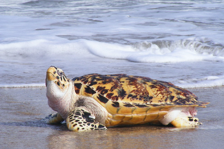
Caretta Caretta (Loggerhead Sea Turtles): This beach is one of the few remaining sites in the Mediterranean where endangered Loggerhead sea turtles consistently return to lay their eggs. Durante the summer, volunteers from Legambiente monitor the beach overnight and rope off nesting areas to protect them from foot traffic. While you likely won't see them on the sand during the day, booking a respectful boat tour around the island frequently results in spotting them surfacing for air in the deeper waters.
Coastal Fish and Snorkeling: Bring your snorkel. The rocky edges of the bay and the waters surrounding the Isola dei Conigli are teeming with Mediterranean marine life. You can expect to see large schools of saddled seabream, ornate wrasse, and occasionally small stingrays gliding along the sandy bottom.
Best Time to Go
Lampedusa is a small island, and choosing the right time to visit is critical for ensuring a comfortable, deeply relaxing experience.
The Ultimate Sweet Spots (Late May to June & September to October): These shoulder months are the pinnacle of the Lampedusa experience, especially for travelers who appreciate a refined, unhurried pace. The weather is blissfully warm, the water is inviting, and you completely avoid the overwhelming throngs of peak-season tourists. The walk down to the beach is much more comfortable without the blistering mid-summer heat.
Peak Summer (July to August): This is when Italians take their national holidays, and Lampedusa becomes incredibly crowded. The heat is intense (frequently exceeding 90°F/32°C), and access to Spiaggia dei Conigli is strictly regulated with timed entry slots that sell out well in advance. While the water is fantastic, the crowds and the heat can detract from the relaxation.
Winter (November to April): Many of the island's boutique hotels and excellent seafood restaurants close for the season. While the stark, arid landscapes are beautiful for hiking, it is not the ideal time for a classic beach vacation.
Getting There, Getting Around, & Where to Stay
Getting There
Despite its remote location, getting to Lampedusa is surprisingly straightforward if you plan ahead.
By Air:Lampedusa Airport (LMP) is tiny but highly functional. You can fly directly here via domestic flights from major Italian hubs like Rome, Milan, and Palermo.
By Ferry: If you are already exploring Sicily and prefer a slower pace, you can take an overnight ferry or a faster hydrofoil from Porto Empedocle (near Agrigento, Sicily).
Getting Around
Lampedusa is only about seven miles long. While there is a local bus, having your own transport offers the freedom to explore at a comfortable pace.
Rental Car (Mehari): The classic way to get around Lampedusa is by renting a vintage, open-air Citroën Mehari or a standard compact car. It makes getting to the beach trailheads and excellent dinner spots completely stress-free.
Scooters: Highly popular, though a car is generally recommended for better comfort and shade during the hotter parts of the day.
Where to Stay
Lampedusa does not do massive mega-resorts; it specializes in authentic, charming Mediterranean hospitality.
Dammusi: For a truly unique and comfortable stay, book a dammuso. These are traditional, flat-roofed stone houses originally built by the Arabs, now modernized into beautiful boutique accommodations. They remain naturally cool and are often surrounded by quiet, beautifully manicured cactus gardens.
Lampedusa Town: Staying in or near the main town around the old port offers immediate access to the island's best seafood restaurants and cafes, making evening strolls for gelato effortless.
Things To Do
Lampedusa is a destination that encourages you to slow down. The best activities here involve effortless appreciation of the sea.
See the "Flying Boats" at Tabaccara: Just one cove over from Spiaggia dei Conigli is La Tabaccara. This bay is famous for water so flawlessly clear and still that the boats anchored there appear to be floating in mid-air, casting crisp shadows on the sea floor 20 feet below. It is an incredible optical illusion and a phenomenal spot for a swim from a boat.
The Descent to Rabbit Beach: The walk down to Spiaggia dei Conigli is part of the experience. From the parking area, a well-paved, terraced stone path winds down the cliffside, offering spectacular, panoramic views of the bay below. The walk takes about 15 to 20 minutes. Take it slow, bring plenty of water, and utilize the shaded rest stops along the way.
Charter a Boat Tour: If you prefer to skip the walk down to the beach, or simply want to see the coastline in total comfort, booking a boat tour is a must. Small, comfortable wooden boats depart from the main port daily. The captains will take you to hidden coves, serve a fantastic lunch of fresh pasta and local wine on board, and drop anchor just outside the Rabbit Beach reserve.
Dine on Sicilian-African Fusion: Because of its location, Lampedusa's cuisine is a magnificent blend of Sicilian tradition and North African influence. Enjoying a slow, refined dinner is the highlight of the evening. Look for dishes like Couscous di Pesce (fish couscous) or impeccably fresh red shrimp.
Watch the Sunset at Capo Ponente: Drive to the extreme western tip of the island, Capo Ponente, for sunset. The towering limestone cliffs drop vertically into the Mediterranean here. There is very little walking required; you can simply park, find a comfortable spot along the wall, and watch the sun melt seamlessly into the endless horizon.
The Ultimate Guide to Navagio Beach: The Spectacular Shipwreck of Zakynthos
When it comes to the most photographed, instantly recognizable coastlines in Europe, Navagio Beach on the Greek island of Zakynthos holds a legendary status. Framed by towering, vertical limestone cliffs and kissed by water so blindingly blue it looks artificially colored, this cove is a masterclass in dramatic Mediterranean beauty. Welcome to the ultimate travel guide to Navagio Beach, famously known as Shipwreck Beach. While recent geological events have shifted how visitors interact with the cove, its visual majesty remains completely undiminished. Whether you want to view it from a comfortable, shaded catamaran or gaze down upon it from a secure clifftop platform, this comprehensive guide covers everything you need to know to safely and comfortably experience this Ionian jewel.
Why It’s Worth Knowing About
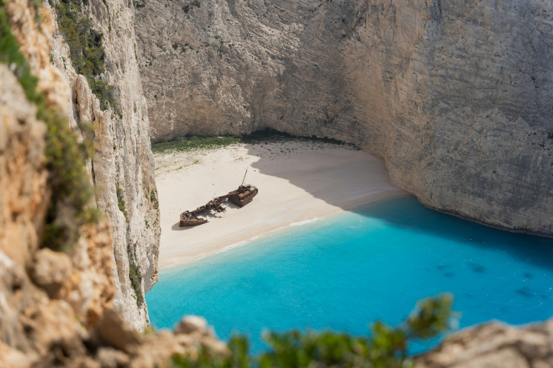
Navagio Beach is a destination defined by a singular, striking contrast: pristine natural beauty colliding with a rusted, decaying piece of modern history. In October 1980, a coastal freighter named the MV Panagiotis ran aground in this remote, unnamed cove during stormy weather. The ship, allegedly smuggling contraband, was abandoned by its crew and left to the mercy of the Ionian Sea. Over the decades, the ocean relentlessly pushed the rusted hull high onto the gleaming white pebbles, inadvertently creating one of the most visually stunning scenes on the planet.
What makes Navagio incredibly important to know about right now is its current preservation and safety status. The towering limestone cliffs that make the bay so spectacular are also geologically active. Following a series of rockfalls and a 2022 earthquake, Greek authorities have strictly closed the beach itself to landings through at least October 31, 2026. This means you cannot currently walk on the sand or swim in the bay. However, this closure has actually improved the visual experience for many travelers. Instead of fighting through massive crowds of tourists clustered around the rusty hull, visitors can now appreciate the pristine, untrammeled beauty of the beach exactly as it looks in photographs—viewed gracefully from a boat holding its position just offshore, or from the panoramic clifftops above. It is a highly accessible, low-impact excursion that requires no strenuous hiking to appreciate.
Water Data: Temperature & Clarity
Navagio Beach is located on the northwestern coast of Zakynthos, facing the open Ionian Sea. The water here is famous for a very specific, surreal aesthetic.
Water Temperatures by Season
The Ionian Sea is generally milder and slightly warmer than the Aegean Sea (which surrounds islands like Mykonos or Santorini), offering an exceptionally comfortable climate.
Winter (Dec - Feb): 59°F - 62°F (15°C - 17°C). Cold and brisk. Boat tours to the northwest coast generally cease operating during these months.
Spring (Mar - May): 63°F - 68°F (17°C - 20°C). Refreshing. By late May, the water surrounding Zakynthos is warming up beautifully for coastal cruising.
Summer (Jun - Aug): 75°F - 81°F (24°C - 27°C). Supremely comfortable and bath-like. It provides the perfect temperature for swimming at alternative, open beaches nearby.
Fall (Sep - Nov): 71°F - 77°F (22°C - 25°C). September holds the peak summer warmth perfectly, making it an ideal time for water-based tours before late autumn cooling.
Water Clarity and Color
The water at Navagio is not just clear; it is a milky, electric, almost neon blue. This breathtaking color is entirely natural. The surrounding cliffs are composed of white limestone. As the sea continuously laps against the rocks, microscopic particles of limestone dissolve and become suspended in the water. When the intense Greek sunlight hits these suspended particles, it reflects an impossible, glowing turquoise hue that practically defies description.
Marine Life
While the immediate bay of Navagio is closed to swimming, the surrounding waters of Zakynthos—particularly the southern and western coasts—are home to one of the most important marine ecosystems in the Mediterranean.
Loggerhead Sea Turtles (Caretta Caretta): Zakynthos is globally renowned as the premier nesting ground for the endangered Loggerhead sea turtle. While they primarily nest on the southern beaches of the island (in the Bay of Laganas), it is very common to spot them surfacing for air while you are cruising the western coastline on a boat tour toward Navagio.
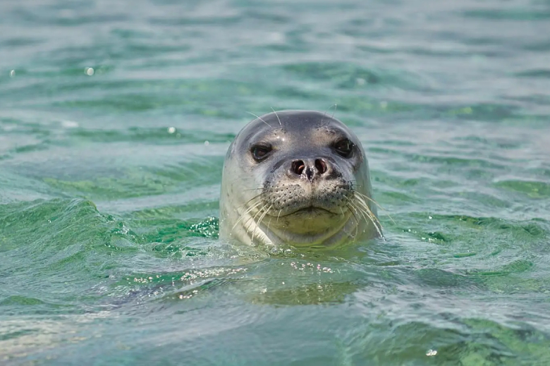
Mediterranean Monk Seals: The remote sea caves dotting the northwestern coast near Navagio provide a sanctuary for the critically endangered Mediterranean Monk Seal. Sightings are extremely rare, but the protection of this rugged coastline helps ensure their survival.
Dolphins: The deep, nutrient-rich waters of the Ionian Sea frequently attract pods of common and bottlenose dolphins. If you take an early morning or sunset boat tour to the shipwreck, keep an eye on the bow wake—dolphins love to swim alongside the boats as they cruise up the coast.
Best Time to Go
Zakynthos enjoys a brilliant Mediterranean climate, but choosing the right time to visit the Shipwreck depends heavily on comfort and lighting.
The Golden Shoulder Seasons (May-June & September-October): For those seeking a relaxed, highly comfortable pace, these months are flawless. The punishing heat of peak summer is absent, the Ionian Sea is calm and inviting, and the large tour buses have either yet to arrive or have already left.
Peak Summer (July & August): The weather is reliably hot, sunny, and dry. Because the beach faces west, the sun does not fully illuminate the sand and the shipwreck until around 11:00 AM. If you are taking a boat tour during these months, opt for a late-morning departure to see the water glowing at its brightest, but ensure your boat has ample shade to escape the midday heat.
Winter (November to April): Not recommended. The island largely shuts down, heavy rains are common, and the sea conditions on the rugged west coast often prevent boats from safely navigating to the bay.
Getting There, Getting Around, & Where to Stay
Getting There
Zakynthos (also known as Zante) is highly accessible from the Greek mainland and major European hubs.
Fly:Zakynthos International Airport (ZTH) receives direct flights from Athens (a quick 45-minute hop) and numerous direct seasonal flights from the UK, Germany, and Italy.
Ferry: If you are driving or island-hopping, comfortable, large-scale ferries operate daily from the mainland port of Kyllini, taking about 1.5 hours to reach Zakynthos Town.
Getting Around
Rental Car: A car is highly recommended if you want to explore the island at your own pace, visit the traditional mountain villages, or drive to the Navagio clifftop viewpoint.
Private Drivers / Taxis: If you prefer not to drive, arranging a private driver for a day trip to the northern sights is a stress-free, deeply comfortable alternative.
Where to Stay
The North (Agios Nikolaos / Volimes): This area is serene, authentic, and spectacularly beautiful. It is dotted with luxury, private pool villas and boutique hotels. Staying here puts you just a short boat ride away from Navagio Beach and the Blue Caves.
Zakynthos Town: For a touch of Venetian history, staying near the main town offers charming pedestrian streets, excellent waterfront dining, and easy access to local culture.
Vasilikos Peninsula (The Southeast): If you want to combine your boat trip to the shipwreck with days spent relaxing on the island's best sandy, swimmable beaches, the Vasilikos area offers lush pine forests and quiet, upscale resort options.
Things To Do
While you cannot step onto the sand of Navagio, the ways you can view and experience this coastline are completely safe, highly accessible, and deeply rewarding.
View from the Clifftop Platform: For the iconic, panoramic photograph that graces every travel magazine, drive to the official Navagio Beach Viewpoint near the village of Anafonitria.
The Greek authorities have maintained a secure, fenced observation deck that hangs over the edge of the cliffs. It is accessible via a short, flat walk from the gravel parking area. Because the railing has been reinforced and pulled back to a sensible, safe distance, it offers a spectacular, worry-free vantage point. Tip: Arrive between 9:00 AM and 11:00 AM to beat the crowds and see the bay before the boats arrive.
Take a Premium Boat Charter: The absolute best way to experience the scale of the cliffs is from the water. Skip the massive, 200-person party boats and charter a small, private speedboat or a comfortable, shaded catamaran from the northern ports of Agios Nikolaos or Porto Vromi. Under current regulations, boats may enter the bay and hold position roughly 50 meters offshore, offering an unobstructed view from the comfort of a cushioned seat.
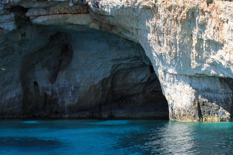
Explore the Blue Caves: Nearly all boat tours to Navagio will include a stop at the Blue Caves on the island's northern tip at Cape Skinari. These are a series of natural limestone arches and sea caves. When the sunlight filters through the water, it reflects off the white seabed, illuminating the inside of the caves with a mesmerizing, glowing blue light.
Photo Credit: Dimitri Mourousiadis on Instagram
Dine in a Traditional Mountain Village: After viewing the shipwreck from the cliffs, take a leisurely drive through the traditional mountain villages of Volimes or Exo Chora. These quiet, historic hamlets are famous for their local honey, handmade lace, and incredibly welcoming family-run tavernas where you can enjoy authentic Zakynthian dishes under the shade of ancient olive trees.
The Ultimate Guide to Pink Sands Beach: Harbour Island’s Blush-Colored Masterpiece
When you imagine the quintessential Bahamian escape, your mind likely drifts to massive resorts in Nassau or the bustling cruise ports of Freeport. But if you venture just a bit further to a tiny, three-and-a-half-mile-long speck of land called Harbour Island, you will discover a completely different world. Affectionately known as "Briland" by the locals, this island is a sanctuary of understated elegance, colonial charm, and one of the most visually stunning coastlines on the planet. Welcome to the ultimate travel guide to Pink Sands Beach. Whether you are seeking a highly refined, low-impact coastal retreat, planning your next great culinary adventure, or simply looking to float in incredibly warm, gin-clear waters, this comprehensive guide covers everything you need to know about this blush-colored masterpiece.
Why It’s Worth Knowing About
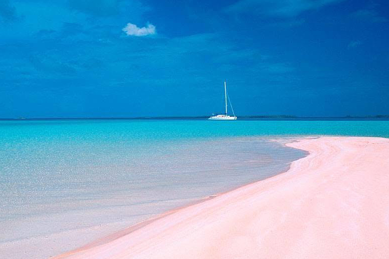
Pink Sands Beach is not just a clever marketing name; the sand genuinely glows with a soft, rose-colored hue that stretches for a flawless three miles along the island's eastern Atlantic edge. The secret to this surreal color is entirely natural. The pink tint comes from Foraminifera, microscopic marine organisms with reddish-pink shells that live abundantly in the coral reefs just offshore. When these organisms complete their life cycle, the ocean waves crush their brightly colored shells and wash them ashore, mixing them with the blindingly white coral sand. The color is most vibrant right at the water's edge where the sand is wet, especially during the golden hours of sunrise and sunset.
Beyond the visual spectacle, Pink Sands Beach is worth knowing about because of its texture and atmosphere. The sand here is uniquely firm and densely packed near the waterline. This makes it incredibly easy on the joints, providing a perfect, flat surface for long, leisurely walks without the exhausting sink-and-slog of typical deep sand. Furthermore, Harbour Island represents the pinnacle of sophisticated, mature travel. You will not find towering mega-casinos, loud spring break crowds, or sprawling all-inclusive resorts here. Instead, the island is dotted with chic boutique hotels and private villas tucked quietly behind lush tropical foliage, offering a profoundly peaceful and refined coastal experience.
Water Data: Temperature & Clarity
Although Pink Sands Beach faces the Atlantic Ocean, the water here is exceptionally calm, thanks to a massive, protective coral reef system that breaks the heavy surf long before it reaches the shoreline.
Water Temperatures by Season
The Bahamas enjoys a beautifully consistent tropical climate. The water remains incredibly inviting year-round, meaning you can leave the wetsuit at home.
Winter (Dec - Feb): 74°F - 76°F. Mild and refreshing. It is wonderfully comfortable for wading and quick swims, especially when escaping the northern cold.
Spring (Mar - May): 77°F - 80°F. Warming up beautifully. By late April, the ocean reaches an absolutely perfect temperature for prolonged swimming.
Summer (Jun - Aug): 82°F - 85°F. Bath-like and incredibly warm. It feels like a heated pool, providing the ultimate relaxing soak.
Fall (Sep - Nov): 79°F - 83°F. September holds the peak summer heat. By November, the water drops back to a highly comfortable, refreshing sweet spot.
Water Clarity
The clarity of the water at Pink Sands Beach is nothing short of astonishing. The Bahamian waters are famously described as "gin-clear," and Harbour Island is no exception. Because the outlying reef protects the beach from heavy wave action, the sandy bottom rarely gets churned up. You can wade in up to your chest and still see your toes—and the pastel pink sand beneath them—with absolute, perfect clarity.
Marine Life
The protective reef system that keeps Pink Sands Beach so calm also serves as a thriving, bustling metropolis for Caribbean marine life, making it a fantastic destination for snorkeling and diving.
Sea Turtles: The warm, clear shallows around Harbour Island are frequent grazing grounds for Green and Hawksbill sea turtles. If you snorkel near the coral heads or take a short boat charter to the nearby seagrass beds, it is incredibly common to swim alongside these gentle, graceful creatures.
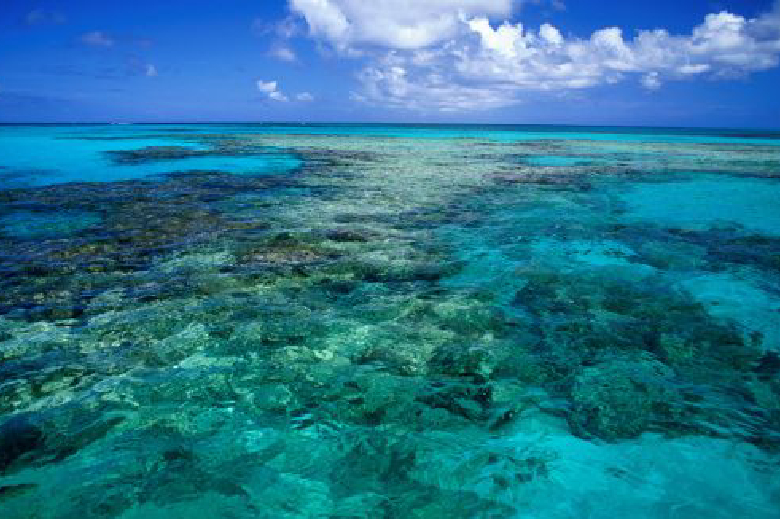
The Devil’s Backbone: Just off the northern edge of Harbour Island lies the infamous "Devil’s Backbone"—a jagged, shallow coral reef that has wrecked more ships than any other reef in the Bahamas. Today, it is one of the premier dive and snorkel sites in the country, teeming with vibrant parrotfish, angelfish, moray eels, and massive schools of snapper.
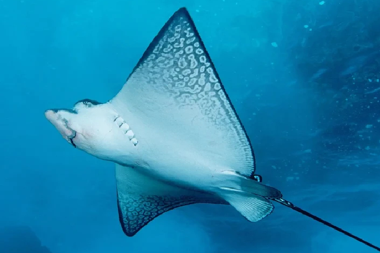
Stingrays and Eagle Rays: While walking the shallow sandbars, keep an eye out for southern stingrays gliding smoothly along the bottom. In the slightly deeper waters near the reef, you might also spot the spectacular spotted eagle ray, flying through the water with its distinct, white-spotted wingspan.
Best Time to Go
Choosing the right time to visit Harbour Island requires balancing perfect weather with the realities of the Atlantic hurricane season and the island's unique seasonal closures.
The Golden Window (November to April): This is the undisputed high season for the Bahamas. The weather is spectacular—think endless blue skies, low humidity, and daytime highs resting comfortably in the upper 70s to low 80s. However, you must book well in advance, as boutique hotel rooms sell out quickly.
The Spring Sweet Spot (May): May is a fantastic, highly recommended time to visit. The winter crowds have thinned out, the ocean has warmed up significantly, and the heavy summer rains have yet to begin.
Hurricane Season & Closures (August to October): While the ocean is at its warmest, this is the peak of the Atlantic hurricane season. It is critical to know that Harbour Island essentially shuts down during September and October. Many of the top hotels, restaurants, and shops close their doors entirely for annual renovations and staff holidays.
Getting There, Getting Around, & Where to Stay
Getting There
The journey to Harbour Island is wonderfully scenic and part of the authentic Bahamian experience.
The Flight: You cannot fly directly onto Harbour Island. Instead, you will fly into North Eleuthera Airport (ELH), which receives direct flights from Miami, Fort Lauderdale, and Atlanta.
The Land Taxi: Upon landing, you will grab a quick, 5-minute land taxi ride to the nearby Eleuthera boat dock.
The Water Taxi: From the dock, you will board a small, covered water taxi for a breezy, 5-minute ride across the bay, dropping you directly into the charming heart of Harbour Island’s Dunmore Town.
Getting Around
One of the greatest joys of Harbour Island is the transportation. There are very few cars here.
Golf Carts: The entire island navigates via golf cart. Renting a golf cart is practically mandatory and incredibly fun. The roads are narrow, safe, and easily traversed by cart.
Walking: Dunmore Town, with its historic, pastel-colored colonial homes and white picket fences, is highly compact and wonderfully walkable.
Where to Stay
Harbour Island specializes in intimate, luxury boutique properties rather than massive chain resorts.
The Dunmore: If you want old-world, refined Bahamian glamour, this is the place. It sits directly on Pink Sands Beach, offering immaculate private cottages and a whisper-quiet, luxurious atmosphere.
Pink Sands Resort: A legendary 20-acre property offering private, Balinese-inspired villas hidden among lush, winding tropical gardens. It provides unparalleled privacy and immediate access to the beach.
Coral Sands Hotel: Sitting right on the ocean, this boutique hotel offers a slightly more modern aesthetic, an incredible beachfront restaurant, and an incredibly warm, accommodating staff.
Things To Do
A trip to Harbour Island is about embracing a slower, more refined pace. Your itinerary should prioritize culinary indulgence, easy exploration, and long hours by the water.
Walk the Pink Sands: Because the sand is incredibly firm near the water, Pink Sands Beach is arguably one of the best walking beaches in the world. Wake up early, leave your shoes at your resort, and enjoy a low-impact, three-mile stroll as the morning sun illuminates the pink hues of the shoreline.
Explore Dunmore Town by Golf Cart: Spend an afternoon zipping around the historic streets of Dunmore Town in your golf cart. The architecture is stunning—picture centuries-old, Loyalist-style cottages painted in vibrant shades of mint, peach, and periwinkle.
Dine at the Queen Conch: You cannot visit the Bahamas without trying fresh conch salad. Head down to the bay side of the island and pull a stool up to the Queen Conch. Watch the locals expertly chop fresh conch, tomatoes, onions, and bell peppers, tossing it with fresh citrus right before your eyes.
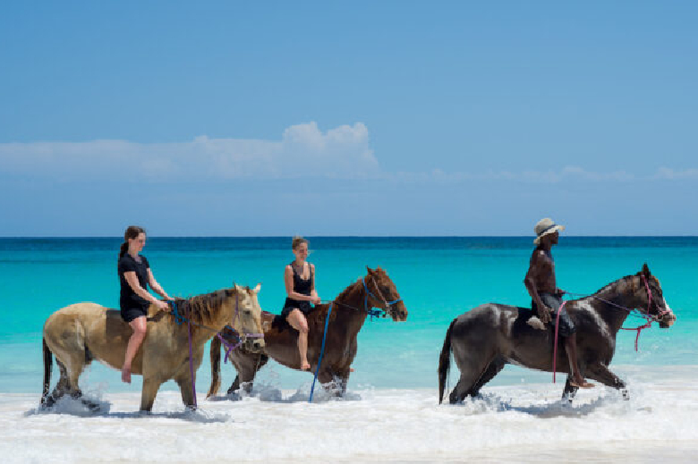
Horseback Riding on the Beach: For a truly cinematic experience, local stables offer guided horseback rides directly on Pink Sands Beach. Riding along the edge of the turquoise water as the ocean breeze cools you down is an unforgettable, low-stress adventure.
Enjoy a Refined Sunset Dinner: While the sun sets on the bay side of the island (opposite the beach), the evening culinary scene here is world-class. Book a table at The Landing, a historic boutique hotel, or enjoy the elegant dining room at Malcolm 51. The focus is on impeccably fresh, locally sourced seafood served in a sophisticated, relaxed atmosphere.
The Ultimate Guide to Baía do Sancho: Brazil’s Untouched Island Eden
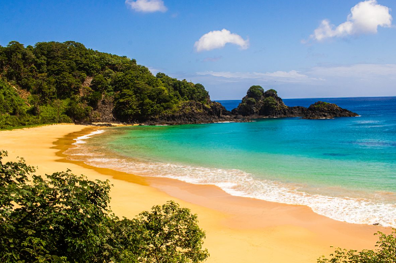
When discerning travelers and global beach critics compile their lists of the world's most spectacular shorelines, one name consistently dominates the number one spot: Baía do Sancho. Hidden away on the volcanic archipelago of Fernando de Noronha, roughly 220 miles off the northeastern coast of Brazil, this remote paradise is the ultimate expression of unspoiled tropical beauty. Welcome to the ultimate travel guide to Baía do Sancho. If your idea of a perfect beach involves pristine ecology, dramatic cliffside descents, and swimming alongside wild sea turtles in water as clear as glass, you have found your holy grail. From navigating the island's strict environmental protections to timing your visit for the calmest seas, this comprehensive guide covers everything you need to know about Brazil's most celebrated coastal sanctuary.
Why It’s Worth Knowing About
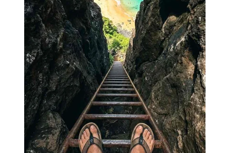
Baía do Sancho is not a beach you simply stumble upon; it is a highly protected ecological treasure that demands a bit of adventurous spirit to access. The beach is enclosed by towering, lushly vegetated cliffs that curve into a perfect, sweeping crescent. Because there are no roads leading directly to the sand, reaching Baía do Sancho requires a unique journey. Visitors must walk along a scenic cliff-top trail before descending through a narrow crevasse in the rock face via a series of steep, metal ladders. As you emerge from the rock and step onto the blindingly white sand, the sense of isolation and discovery is profoundly moving.
Beyond the dramatic entrance, Baía do Sancho is worth knowing about because it is a masterclass in environmental conservation. The entire Fernando de Noronha archipelago is a designated UNESCO World Heritage Site and a Brazilian national marine park. To protect the fragile ecosystem, the local government imposes a strict daily cap on the number of visitors allowed on the island and charges an environmental preservation fee. This means that even on its busiest days, Baía do Sancho never feels crowded. There are no beach clubs, no jet skis, and no beachfront vendors—just pure, raw nature. It is a destination that prioritizes the preservation of the environment over mass tourism, offering an incredibly rare, pristine beach experience.
Water Data: Temperature & Clarity
Floating in the equatorial Atlantic Ocean, Fernando de Noronha enjoys a distinctly tropical climate. The water conditions at Baía do Sancho are famously inviting, though they shift depending on the island's wet and dry seasons.
Water Temperatures by Season
The ocean here remains wonderfully warm year-round, meaning you will never need a wetsuit for casual swimming or snorkeling.
Spring (Sep - Nov): 79°F - 81°F (26°C - 27°C). Flawlessly warm. This is the dry season, making the water feel perfectly refreshing against the tropical heat.
Summer (Dec - Feb): 81°F - 82°F (27°C - 28°C). Bath-like and incredibly comfortable. As the wet season approaches, the water remains spectacular for long swims.
Fall (Mar - May): 82°F - 84°F (28°C - 29°C). The peak of ocean warmth. The water feels like a heated pool, though this aligns with the island's rainiest months.
Winter (Jun - Aug): 80°F - 82°F (27°C - 28°C). Consistently warm. The transition back into the dry season brings fantastic swimming conditions.
Water Clarity
Durante the dry season (roughly August to December), the ocean at Baía do Sancho is at its absolute calmest. The water transforms into a giant, waveless swimming pool with a vibrant emerald-cyan hue. Visibility is astonishing, often exceeding 160 feet (50 meters), making it one of the premier snorkeling and diving destinations on the planet. During the rainy season, passing swells can occasionally churn the water, but it largely retains its striking translucence.
Marine Life
Because it is a highly regulated national marine park, the biodiversity in the waters surrounding Baía do Sancho is staggering. It is a bustling nursery and sanctuary for South Atlantic marine life.
Spinner Dolphins: Fernando de Noronha is home to the largest known resident population of spinner dolphins in the world. While the main dolphin bay (Baía dos Golfinhos) is adjacent to Sancho and strictly off-limits to swimmers, these playful mammals frequently pass through Baía do Sancho. If you take a boat tour to the beach, it is incredibly common for massive pods to surf the wake of your boat, leaping and spinning acrobatically in the air.
Sea Turtles: The bay is a vital feeding and resting ground for hawksbill and green sea turtles. If you strap on a snorkel mask and swim just a few yards offshore, you are almost guaranteed to encounter them gliding gracefully over the rocky reef formations.
Eagle Rays and Reef Sharks: The crystal-clear shallows are frequently visited by spotted eagle rays and small, harmless lemon and reef sharks. The sheer abundance of tropical fish—ranging from vibrant parrotfish to schooling snappers—makes swimming here feel like floating inside a meticulously maintained aquarium.
Timing your trip to Fernando de Noronha requires navigating the island's distinct wet and dry seasons, as well as its strict visitor limits.
The Ultimate Sweet Spot (August to December): This is the dry season and universally considered the best time to visit Baía do Sancho. The Atlantic Ocean is practically waveless, maximizing the legendary water clarity for snorkeling. The skies are blue, the humidity is manageable, and the beach is at its most idyllic.
The Wet Season (March to July): During these months, the island receives heavy, frequent rainfall, turning the volcanic peaks lush and vibrantly green. However, the rain can occasionally compromise water visibility, and the trails can become muddy.
Surf Season (January to March): If you are an experienced surfer, the early months of the year bring heavy swells to the island, earning Fernando de Noronha the nickname "The Hawaii of Brazil." While great for surfing at other beaches on the island, the crashing waves make swimming and snorkeling at Baía do Sancho much more difficult.
Getting There, Getting Around, & Where to Stay
Getting There
Because it is an isolated archipelago, reaching Fernando de Noronha requires a bit of logistical planning.
The Flights: You cannot fly directly to the island from outside Brazil. You must first fly into a mainland gateway city, typically Recife (REC) or Natal (NAT). From there, you will take a connecting 1-hour domestic flight to the small Fernando de Noronha Airport (FEN).
The Fees: Before arriving, you must pay two mandatory fees: the Environmental Preservation Tax (charged per day of your stay) and the Marine National Park ticket (valid for 10 days, required to access Baía do Sancho).
Getting Around
The island is small, measuring just 7 miles long, but it is hilly.
Dune Buggies: The most popular and fun way to explore the island is by renting an open-air beach buggy. It allows you to easily navigate the unpaved dirt roads leading to the national park entrances.
Public Bus: A reliable, cheap public bus runs back and forth along the island's single main highway, though it won't take you all the way down the dirt trails to the beaches.
Taxis: Island taxis (usually white buggies or SUVs) are readily available and can be called from any hotel or restaurant.
Where to Stay
Fernando de Noronha does not have massive, towering mega-resorts. Instead, accommodations consist of pousadas (traditional Brazilian guesthouses), ranging from rustic to ultra-luxurious.
Vila dos Remédios: The historic main village of the island. Staying here puts you within walking distance of the best restaurants, lively bars, and the historic fort.
Floresta Velha & Sueste: These neighborhoods offer high-end, luxury pousadas that provide incredible ocean views, infinity pools, and deep tranquility, perfect for honeymooners.
Vila do Trinta: A more residential area offering mid-range and budget-friendly pousadas, favored by backpackers and scuba divers who spend all their time out exploring.
Things To Do
While Baía do Sancho is an incredible place to simply lay on the sand, the strict preservation rules mean you must bring your own gear to actively explore.
Navigate the Cliff Ladders: The descent to the beach is an adventure in itself. From the national park visitor center, you will walk along an accessible wooden boardwalk offering sweeping panoramic views. To reach the sand, you must climb down through a tight, vertical crevasse in the cliff using secure metal ladders. It is thrilling, but requires a reasonable level of mobility.
Snorkel the Right Flank: Bring your own mask and snorkel (there are no rental shacks on the beach). The best snorkeling is found by swimming out toward the right side of the bay, near the rocky cliff edge. This is where the coral formations are densest, and where you are most likely to spot sea turtles, octopuses, and reef sharks.
Take a Boat Tour: If the cliff ladders seem too daunting, the best alternative is booking a coastal boat tour. These boats depart from the main harbor, cruise past the dolphin bay, and anchor directly in Baía do Sancho. You can jump off the boat directly into the crystal-clear water, bypassing the hike entirely.
Watch the Sunset at Dois Irmãos: While you cannot stay on Baía do Sancho after dark, you can end your day just a short distance away. Head to the nearby Baía dos Porcos or the Cacimba do Padre beach to watch the sunset behind the Morro Dois Irmãos (Two Brothers Hill). These iconic twin rock formations jut out of the ocean and create one of the most photographed, spectacular sunset silhouettes in all of South America.
The Ultimate Guide to Whitehaven Beach: Australia’s Purest Paradise
When you conjure an image of the absolute perfect beach—the kind that looks heavily edited in travel brochures—you are likely picturing Whitehaven Beach. Located in the heart of the Great Barrier Reef within Australia’s Whitsunday Islands, this awe-inspiring stretch of coastline regularly claims the title of the best beach in the world. Welcome to the ultimate travel guide to Whitehaven Beach. Offering an unparalleled blend of remote, untouched natural beauty and highly accessible, world-class comfort, it is a destination that delivers a profoundly moving coastal experience. Whether you prefer viewing the swirling sands from the plush deck of a stable catamaran or taking a gentle scenic stroll to one of the world's most famous lookouts, this comprehensive guide covers everything you need to know.
Why It’s Worth Knowing About
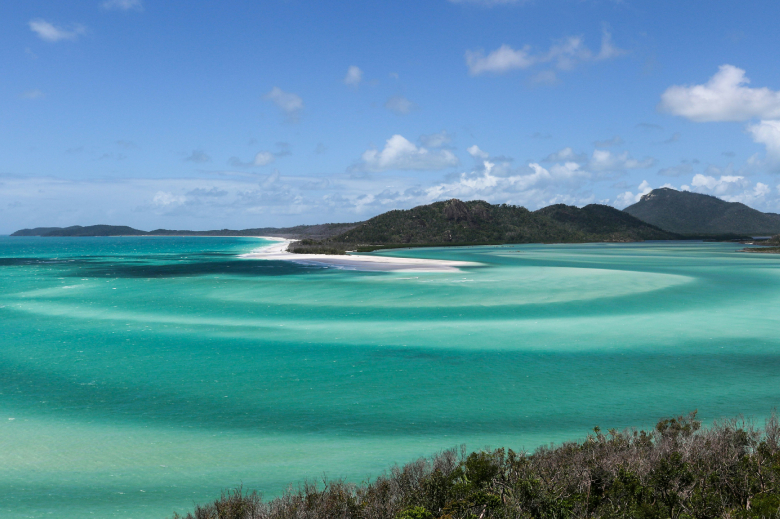
Whitehaven Beach is a geological marvel spanning just over four miles along Whitsunday Island, the largest of the 74 islands in the archipelago. The secret to its global fame lies entirely in its sand. Unlike most beaches composed of pulverized coral or crushed shells, Whitehaven's sand is 98.9% pure silica. This incredibly fine, powdery substance is blindingly white. Because silica does not retain heat, the sand remains remarkably cool to the touch even under the intense midday Australian sun—meaning you can walk barefoot in absolute comfort all day long.
At the northern end of the beach lies Hill Inlet, a stunning cove where the tide shifts the silica sand and the water to create a brilliant, swirling fusion of turquoise, blue, and stark white. Because the tide shifts daily, the swirling pattern is never the same twice. Furthermore, Whitehaven Beach is worth knowing about because it is a highly protected national park. There are no high-rise resorts, no bustling restaurants, and no permanent structures on the beach itself. This strict environmental protection ensures that the island remains a pristine, immaculate wilderness, allowing visitors to experience the Great Barrier Reef exactly as nature intended.
Water Data: Temperature & Clarity
Situated in the Coral Sea off the coast of Queensland, the Whitsundays enjoy a tropical climate. The water here is inviting, but it comes with specific seasonal considerations unique to northern Australia.
Water Temperatures by Season
The Coral Sea offers comfortable swimming year-round, though the tropical seasons are divided more distinctly into the "Dry Season" and the "Wet Season."
Winter (Jun - Aug): 71°F - 75°F (22°C - 24°C). Refreshing and brisk. Perfect for those who prefer comfortable, low-humidity days, though a light wetsuit might be preferred for extended snorkeling.
Spring (Sep - Nov): 77°F - 80°F (25°C - 27°C). The absolute sweet spot. The water is delightfully warm and perfectly balances the rising air temperatures.
Summer (Dec - Feb): 82°F - 84°F (28°C - 29°C). Bath-like and incredibly warm. This is the wet season, bringing high humidity and frequent tropical downpours.
Fall (Mar - May): 79°F - 82°F (26°C - 28°C). Lingering summer warmth. The water is fantastic, though the weather can still be unpredictable early in the season.
Water Clarity and Stinger Season
The water clarity at Whitehaven is spectacular. The bright white silica sand acts as a massive underwater reflector, giving the shallows an almost neon-turquoise glow. Important Note on Stingers: From late October through May (the warmer months), the tropical waters of northern Queensland are home to marine stingers, including the Irukandji and Box Jellyfish. While this sounds intimidating, it is easily managed. All reputable tour operators provide lightweight, full-body Lycra "stinger suits." These suits not only protect you from jellyfish but also offer fantastic UV sun protection, allowing you to swim and float in complete comfort and safety.
Marine Life
Because Whitsunday Island sits within the Great Barrier Reef Marine Park, the surrounding waters are a sanctuary for some of the ocean's most magnificent creatures.
Sea Turtles: The shallow, seagrass-rich waters around the Whitsundays are prime feeding grounds for Green and Loggerhead sea turtles. If you are snorkeling near the fringing reefs at the southern end of the beach, or even simply wading waist-deep in the crystal-clear water, it is incredibly common to see these gentle giants glide effortlessly past you.
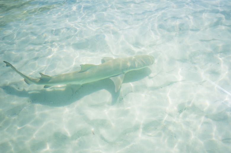
Lemon Sharks and Stingrays: In the incredibly shallow, warm waters of Hill Inlet, you will often spot small, yellow-tinted shadows darting across the sand. These are juvenile Lemon Sharks. They use the protected inlet as a nursery to grow before heading out to the deeper reef. They are entirely harmless and generally swim away if approached, but watching them hunt small fish in ankle-deep water is a fascinating experience.
Tropical Reef Fish: While Whitehaven itself is mostly sandy, the nearby rocky outcrops house vibrant coral bommies. Snorkeling here will introduce you to a kaleidoscope of tropical fish, including the massive, friendly Maori Wrasse, vibrant parrotfish, and anemonefish.
Best Time to Go
Choosing the right time to visit the Whitsundays ensures the most comfortable climate and dictates what wildlife you might encounter.
The Ultimate Sweet Spot (September to October): This is widely considered the best time to visit. The humidity is low, the skies are generally clear, and the water is warming up beautifully. Crucially, you are visiting just before the peak marine stinger season officially begins, meaning you can often swim comfortably.
Whale Season (July to August): Winter in the Whitsundays is spectacular for wildlife lovers. Thousands of humpback whales migrate to these warm, protected waters to give birth and nurse their calves. The air is crisp and comfortable (highs in the mid-70s), making it ideal for those who prefer to avoid extreme tropical heat, even if the water is slightly cooler.
The Wet Season (January to March): This is the least ideal time for a visit. The humidity can be oppressive, tropical cyclones are a possibility, and marine stingers are highly active. While you can often score great travel deals, the unpredictable weather makes it a gamble.
Getting There, Getting Around, & Where to Stay
Getting There
Because Whitehaven Beach is on an uninhabited island, your journey will begin at one of the region's main hubs.
Hamilton Island Airport (HTI): This is the most convenient option. Hamilton Island is a developed resort island with its own commercial airport offering direct flights from Sydney, Melbourne, and Brisbane.
Whitsunday Coast Airport (PPP): Located on the mainland in Proserpine, this airport services the coastal town of Airlie Beach, which acts as the primary mainland gateway to the islands.
Getting Around
Accessing Whitehaven requires a boat, seaplane, or helicopter.
Luxury Catamarans: For the most comfortable, stable ride, book a tour on a large sailing or motorized catamaran. Their wide dual hulls minimize rocking, ensuring a smooth, relaxing journey across the passage, complete with shaded decks and onboard catering.
Scenic Flights: For a truly unforgettable and effortless experience, book a helicopter or seaplane. You will fly over the swirling sands of Hill Inlet and the famous Heart Reef before landing directly on the water at Whitehaven Beach.
Where to Stay
Hamilton Island: The premier choice for seamless comfort. It offers everything from high-end luxury resorts (like the world-renowned qualia) to comfortable apartments. The island is entirely car-free; guests get around using electric golf buggies, adding a quiet, relaxed charm to the stay.
Airlie Beach (The Mainland): If you prefer to stay on the mainland, Airlie Beach offers excellent, upscale resort options with stunning marina views and easy walking access to fantastic restaurants and departure terminals.
Hayman Island: For the ultimate in secluded luxury, the InterContinental Hayman Island Resort occupies its own private island. It is spectacular, quiet, and offers private yacht charters directly to Whitehaven.
Things To Do
A day at Whitehaven is all about effortless appreciation of the natural world, combining gentle exploration with pure relaxation.
Walk to the Hill Inlet Lookout: This is the single most important activity on the island. Tour boats typically drop passengers at Tongue Bay, where a well-maintained, gently sloping bushwalking trail leads up to the Hill Inlet Lookout. The walk takes about 15 to 20 minutes and is highly accessible, offering plenty of spots to rest. The reward at the top is the iconic, panoramic view of the swirling silica sands below.
Enjoy the Silica Sand: Once you descend to the beach, take off your shoes. The impossibly fine silica sand is so pure that it is famously used to polish jewelry. Find a quiet stretch of the four-mile beach, set up an umbrella, and simply enjoy the extraordinary contrast between the white sand and the turquoise water.
Take a Scenic Flight over Heart Reef: If there is one place in the world to splurge on a scenic flight, it is here. A helicopter or seaplane tour will take you beyond Whitehaven to the outer Great Barrier Reef to see Heart Reef—a stunning, naturally formed coral composition in the shape of a perfect heart.
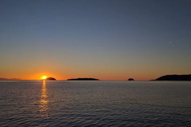
Sail the Whitsunday Passage at Sunset: After a day on the beach, there is no better way to unwind than on the water. Charter a comfortable, stable catamaran for a sunset sail back to your resort. Sip a glass of Australian sparkling wine, enjoy fresh local seafood canapés, and watch the sun dip behind the islands, painting the sky and the Coral Sea in spectacular shades of gold and violet.